Has a tsunami ever hit Bali?
Yes, but rarely, and the written record is short. The worst event came in November 1815, when an earthquake of magnitude 7.0 to 7.3 off the north coast set off landslides and a local tsunami of about 2 to 3 meters. Researchers put the death toll at 10,000 to 12,000, most of it from landslides.
Later waves were smaller. A minor tsunami in 1917 caused no damage on the southeast coast. The 1994 earthquake off East Java sent waves of up to 5 meters onto Bali's southwest coast, while East Java saw up to 14 meters. About 250 people died in that event.
| Year | Trigger | Wave on Bali |
|---|---|---|
| 1815 | Magnitude 7.0–7.3 quake and landslides off the north coast | 2–3 m, north coast |
| 1917 | Magnitude 6.6 quake on January 21 | Minor, southeast coast, no damage |
| 1994 | Magnitude 7.8 quake off East Java on June 3 | Up to 5 m, southwest coast |
Source: Wikipedia, 1815 Bali earthquake, 1917 Bali earthquake and 1994 Java earthquake, 2026; Eos Landslide Blog on Faral et al., 2024–2025; University of Washington field survey, 1994
Where would a tsunami near Bali come from?
Two fault systems matter most. To the south, the Indo-Australian plate slides under Java and Bali, and the 1994 wave came from that margin. To the north, the Flores back-arc thrust is the fault that researchers link to the 1815 earthquake.
Local waves are possible too. In June 2024 Daryono, head of BMKG's earthquake and tsunami center, said the megathrust segment south of the Badung Strait could produce a magnitude 8.5 earthquake, with a wave of up to 8 meters at Kusamba in Klungkung. That is a modeled ceiling, not a forecast, and nobody has observed such an event.
Source: Wikipedia, 1815 Bali earthquake, 2026; Detik Bali, report on Daryono's statement at the 2024 Earthquake Field School, June 20, 2024

Want the numbers for your budget?
Gusti Ayu will send the net yield math for your budget on WhatsApp.
How big could a tsunami get on Bali's southern coast?
Nobody can forecast the date or the size, so scientists model worst cases and planners prepare for them. A 2022 BMKG journal study of Tanjung Benoa used a magnitude 8.5 earthquake on the Sumba megathrust.
A separate BMKG scenario south of Lombok, of up to magnitude 8.9, showed waves of 25 to 26 meters in Central Lombok after 15 to 20 minutes. The seismologist who presented it, Pepen Supendi, said in August 2025 that such scenarios exist for preparedness and not to alarm anyone. Treat each figure as a model ceiling for one stretch of coast.
Source: Jurnal Meteorologi dan Geofisika, Vol. 23 No. 1, 2022; Koran Jakarta, BMKG scenario for Lombok, August 26, 2025
Does Bali have a tsunami warning system?
Yes. Indonesia's national system, InaTEWS, launched on November 11, 2008, with a promise of warnings within five minutes of an earthquake. On October 31, 2025 BMKG said the maximum had fallen to three minutes, with accuracy above 90%, and that the upgraded system runs dual centers in Jakarta and Bali. We could not test those figures ourselves.
Sirens are the thinner part of the public record. A 2016 Jakarta Post report counted nine on Bali, including Sanur, Kedonganan, Benoa Bay, Serangan, Nusa Dua, Seririt and Tanah Lot. Officials had asked for 13 more, and the sirens are tested on the 26th of each month at 10 a.m. We found no newer official count, so ask the village office what stands near your plot.
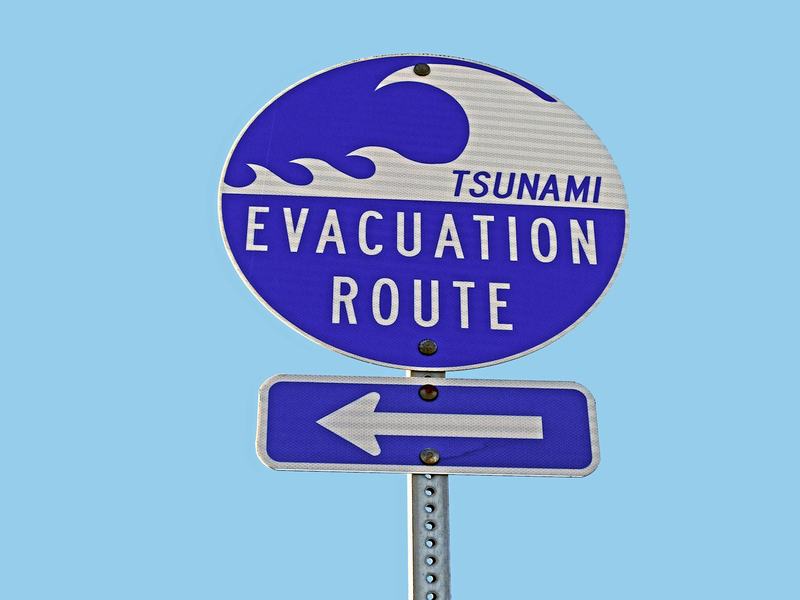
Tanjung Benoa shows what preparation looks like. On May 28, 2022 UNESCO-IOC recognized it as the first Tsunami Ready community in Indonesia. It had met 12 indicators, among them a hazard map, evacuation signs, school drills and vertical shelters in local hotels.
Source: Setneg, InaTEWS launch, November 11, 2008; BMKG, October 31, 2025; Jakarta Post, April 29, 2016; BMKG, Tanjung Benoa Tsunami Ready, May 28, 2022
How long would you have to leave the coast?
Less time than most people expect, and more than none. In the Tanjung Benoa model the wave arrives 20 to 25 minutes after the quake. An alert within three minutes leaves roughly 15 to 20 minutes to move. The standard guidance is simple: if shaking is strong and long, go to high ground at once and don't wait for a siren.
Shelter capacity is the open question. The same study counted eight hotels acting as vertical shelters, with room for about 3,000 people. That is roughly half of the peninsula's 5,684 residents, before any visitors, who can number up to 30,000 in peak season. The authors recommend more shelters at least 20 meters tall.
The beaches at Kuta and Sanur have little natural high ground, so the plan there means tall buildings or inland roads.
Source: Jurnal Meteorologi dan Geofisika, Vol. 23 No. 1, 2022; BMKG, October 31, 2025; Jakarta Post, April 29, 2016
Which parts of Bali sit lowest above sea level?
Elevation, not district name, sets the exposure. We sampled the Copernicus 90-meter elevation model at beach and plateau points. Coastal pixels carry errors of several meters, so treat each value as an order of magnitude.
A beachfront plot near zero is a different proposition from a hillside in Ungasan, even at the same distance from the water. Before paying for land near the sea, order a topographic survey.
- 213
- 139
- 12
- 9
- 7
- 6
- 5
- 0
- 0
Source: Copernicus DEM GLO-90 through Open-Meteo, October 2026; Rise Real Bali sampling
Are earthquakes a bigger concern than tsunamis?
For daily life, yes, because they are far more frequent, though nearly all are too small to feel. The Denpasar geophysics station recorded 547 earthquakes in the Bali region in 2025, against 582 in 2024, and people felt ten of them. The strongest, on April 17, measured magnitude 5.4.
Damage depends on the building as much as the shaking. A magnitude 4.8 earthquake near Karangasem on October 16, 2021 killed three people (BMKG; BNPB). The 1976 earthquake in Buleleng, at magnitude 6.5, killed 573.
Indonesia's current seismic design standard is SNI 1726:2019. Ask the developer which code the structure follows and who signed the calculation. It belongs in the same file as the permit, which our PBG and SLF guide explains.
Source: BBMKG Region III Denpasar via ANTARA and Metro TV, January 4, 2026; BMKG analysis and BNPB report on the Karangasem earthquake, October 16, 2021; Wikipedia, 1976 Bali earthquake; SNI 1726:2019 as cited in Indonesian engineering papers
What should you check before buying near the coast?
A low plot isn't an automatic no. Gather the facts, ask in writing and keep the answers.
Insurance is part of the picture. A standard property policy excludes earthquake, and the extension usually bundles eruption and tsunami, as our villa insurance guide shows. Setback rules for the shoreline sit in zoning, covered in our zoning guide.
- The plot's elevation from a topographic survey, not a phone map
- The distance to the sea, and the walk from the plot to the nearest high ground
- Evacuation signs nearby
- How many floors the building has, and whether guests can reach the roof
- The seismic code and who signed the calculation
- Which perils the policy covers, and what the deductible is per event
What this means for buyers
- Bali's last destructive tsunami on record came in 1815, and the record is short.
- Modeled wave heights are ceilings for specific coasts, not forecasts.
- Plot elevation matters more than district: Kuta and Kedonganan sit near zero, Ungasan and Ubud well above 100 meters.
- Order a survey, walk the escape route, and confirm what your policy covers.
FAQ
Has a tsunami hit Bali before?
Yes. The worst recorded wave came in 1815, at 2 to 3 meters on the north coast, alongside deadly landslides. A minor tsunami in 1917 caused no damage, and a 1994 wave from East Java reached up to 5 meters in the southwest. Records are short, so treat them as a guide only.
Does Bali have tsunami sirens?
Yes. A 2016 report counted nine, including Sanur, Kedonganan, Benoa Bay, Serangan, Nusa Dua and Tanah Lot, with 13 more requested. They're tested on the 26th of each month at 10 a.m. We found no newer official count, so ask locally about the sirens near any plot.
Which areas of Bali are safest from tsunamis?
Higher ground is safer. In our elevation sample, Ubud sat near 213 meters and the Ungasan plateau near 139, while Kuta beach and Kedonganan were close to zero. The numbers are rough, because the model is coarse, so confirm any plot with a topographic survey.
Does villa insurance cover tsunami in Bali?
Not in the base policy. Earthquake cover is an extension that usually bundles volcanic eruption and tsunami. Ask the insurer what the policy names, what the deductible is for each event, and whether coastal plots are excluded. Our villa insurance guide has the regulated rates.
How many earthquakes does Bali have each year?
The Denpasar geophysics station recorded 547 in the Bali region in 2025 and 582 in 2024. People felt ten of them last year, and the strongest measured magnitude 5.4. Most events are far too small to notice, but shallow ones near poorly built houses can still do damage.
How we know this
Event dates, magnitudes and wave heights come from Wikipedia summaries of the scientific literature and from a University of Washington survey of the 1994 event. The 1815 death toll is a range, and the split between landslide and wave deaths comes from a single source. Scenario figures come from a BMKG journal paper and BMKG statements, and they are models, not forecasts. Warning times are BMKG's own claims, and the siren count dates from 2016. For the 2021 Karangasem earthquake we give only the magnitude (BMKG), the date and the death toll reported by BNPB; counts of damaged buildings differ between sources, so we leave them out. This page is not a safety assessment of any plot.
- Wikipedia, Bali earthquakes of 1815, 1917 and 1976, and the 1994 Java earthquake, 2026
- Eos Landslide Blog, 1815 Bali disaster, citing Faral et al., 2024–2025; University of Washington, 1994 tsunami survey
- Jurnal Meteorologi dan Geofisika (BMKG), Vol. 23 No. 1, 2022, tsunami study of Tanjung Benoa
- Detik Bali, June 20, 2024; Koran Jakarta, August 26, 2025
- BMKG, October 31, 2025 and May 28, 2022; Setneg, November 11, 2008; Jakarta Post, April 29, 2016
- BBMKG Region III Denpasar via ANTARA and Metro TV, January 4, 2026
- BNPB, Dampak Gempa Bumi M4,8, Tiga Warga Bali Meninggal Dunia, October 16, 2021; BMKG (Daryono), facts on the Karangasem earthquake of M4.8, October 2021
- Copernicus DEM GLO-90 through Open-Meteo, queried October 2026
By Dmitrii Rogov, Rise Real Bali.
Rise Real Bali is a real estate agency in Bali. We write from the deals we handle and from public data, and we name our sources.
This report is published under the CC BY 4.0 license. You may quote, republish and use the figures and text commercially if you credit "Rise Real Bali", name the license and link to this page. Photos and renderings are not covered by the license: their rights belong to the developers and other rights holders.
Share
WhatsApp