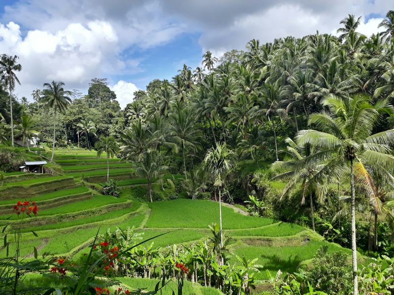
The certificate says whose land it is. The RDTR says what goes on it
Every regency in Bali prepares an RDTR, a detailed spatial plan that assigns each block a zone: housing, tourism, trade, agriculture, protected land. The zone decides whether a villa, a guesthouse or nothing at all can stand on the plot.
Above the RDTR sits the provincial frame. Provincial Regulation 2/2023 on Bali's spatial plan for 2023–2043 replaced Perda 16/2009 and its 2020 amendment. If a contract or pitch deck still cites the 2020 text, someone drafted it against rules that no longer apply.
Buy on the wrong zone and the rest of the paperwork stops mattering. You can't get building approval for a use the plan doesn't allow, and you can't license a rental there either.
Source: Perda Provinsi Bali 2/2023; Tarubali, Bali provincial spatial planning portal
The provincial caps: 50% coverage, 15 meters, 20% parking
Article 95 of Perda 2/2023 sets three numbers for tourism zones. Ground-floor coverage tops out at 50%. No building may rise above 15 meters from the ground. Accommodation must set aside parking equal to at least 20% of its floor area.
The height cap has held for decades. In practice it keeps most buildings on the island to about four stories.
Source: Perda Provinsi Bali 2/2023, Article 95, as published on the Tarubali provincial portal

Not sure which structure fits you?
Gusti Ayu will send a short answer for your case on WhatsApp.
How to read KDB, KLB, KDH and KTB
Inside each zone, the RDTR describes a block with four ratios. They're the difference between a plot that fits a villa and one that fits a garden.
KDB is the share of the plot the ground floor may cover. KLB is the total floor area allowed as a multiple of the plot. KDH is the share that must stay green and unpaved. KTB limits the basement footprint.
Do the math before the deposit. An 800 m² plot (≈ 8,610 sq ft) with KDB 50 and KDH 30 gives you a 400 m² footprint and 240 m² of required greenery. Setbacks from the road and the boundaries come off after that, so the real building area is smaller still.
| Ratio | What it measures | Example |
|---|---|---|
| KDB | Ground-floor coverage | KDB 50: footprint up to 500 m² |
| KLB | Total floor area vs plot area | KLB 2: up to 2,000 m² of floors |
| KDH | Required green, unpaved area | KDH 20: 200 m² stays green |
| KTB | Basement footprint | KTB 30: basement up to 300 m² |
Source: Permen ATR/BPN 11/2021 on spatial plans; Tarubali provincial portal
What the green zone means for a buyer
When buyers say green zone, they usually mean farmland. Within it sits a protected class, LP2B, land set aside for food production and shielded by its own statute, Law 41/2009.
The pull is easy to see. A rice field with a view costs a fraction of a plot in a tourism zone, and the neighbors have already built. That argument doesn't hold. On July 21, 2025, officials began clearing 48 structures at Bingin Beach, saying none of them held permits.
Farmland isn't always off limits for a home, and the RDTR is where you find out. What it won't allow is a commercial villa on a block zoned for agriculture.
Signs the plot is green
- The RDTR shades the block as farmland or LP2B
- Working subak channels
- A price per are well below the next block over
- An offer to sort out the zoning through contacts
Signs the plot can be built on
- Zoned for housing or tourism
- OSS issues the zoning confirmation automatically, because the block sits inside an integrated RDTR
- Utilities in reach
- Permitted buildings of the same type next door, with their own PBG
Source: Law 41/2009 on protected farmland; ABC News, July 22, 2025; Detik, July 23, 2025
The 2025 moratorium and the two 2026 provincial regulations
In September 2025, floods across southern Bali killed at least 18 people. The provincial government then halted the conversion of productive farmland to hotels, villas and restaurants. Published accounts describe the moratorium's reach differently, some by river catchment and some by regency, so the plot's zone is the only reliable test.
Two provincial regulations followed on February 24, 2026. Perda 4/2026 controls the conversion of productive land and bans nominee ownership. Perda 3/2026 protects beaches and the coastal setback, with administrative measures that run from written warnings to demolition.
- July 21, 2025Bingin
48 structures cleared from protected coastal land.
- September 2025Floods and moratorium
At least 18 deaths, then a halt on converting productive farmland.
- February 24, 2026Perda 3/2026 and 4/2026 signed
Coastal protection, farmland conversion and nominee ownership.
Source: ABC News, September 19, 2025; Antara Bali and Balitopik, March 2026; Bisnis Bali, February 26, 2026
How much of Bali has a detailed plan
Whether an RDTR exists for your plot depends on the regency. On February 12, 2026, detailed plans covered 176,005 ha of Bali's 559,001 ha, or 31.49%. The OSS licensing system held 28 of them.
The spread is wide. Badung, Gianyar and Denpasar are fully covered. Tabanan sits at 21.43%, and much of its coast, where building has moved around Kedungu and further west, falls in the uncovered part. Klungkung had no detailed plan at all.
- 100%
- 30.02%
- 23.18%
- 22.75%
- 21.43%
- 9.21%
- 0%
Source: Tarubali, status of RTRW and RDTR across Bali, February 12, 2026
KKPR: automatic where a plan exists, slower where it doesn't
Before any building approval, the project needs KKPR, confirmation that the planned activity fits the spatial plan. It replaced the old location permit.
Where an RDTR exists and sits inside OSS, the system issues the confirmation automatically, often within seconds. Where it doesn't, the file goes to a manual assessment called PKKPR. That takes up to 20 working days from a complete, paid application, and OSS issues it automatically if the deadline passes.
Twenty days won't break a deal, but it belongs in the timeline. Tie the deposit, or at least its refund, to the zoning confirmation.
Source: PP 21/2021 on spatial planning; IZIN.co.id and Easybiz on PKKPR processing, 2026
Penalties for building against the plan
Law 26/2007 on spatial planning, as amended by the Job Creation Law (Law 6/2023), sets criminal penalties for using land against its approved zone. Using space without zoning approval, where it changes the land's function, carries up to 3 years and Rp 1 bn. If it causes damage to property, the ceiling rises to 4 years and Rp 2.5 bn.
Converting protected farmland without approval is a separate offense under Law 41/2009, Article 72: up to 5 years and Rp 1 bn. Courts rarely reach a verdict under these articles, yet they're the legal basis on which demolition orders rest.
The seller walks away from this risk at the sale. The holder of the right to use the plot doesn't.
| Offense | Prison, maximum | Fine, maximum |
|---|---|---|
| Using land against its zone, changing its function (Law 26/2007 as amended) | 3 years | Rp 1 bn |
| The same, causing damage to property | 4 years | Rp 2.5 bn |
| Converting protected farmland, LP2B (Law 41/2009) | 5 years | Rp 1 bn |
Source: Law 26/2007, Article 69, as amended by Law 6/2023, via Kontan and SIP Law Firm; Law 41/2009, Article 72
How to check a plot's zone before the deposit
The check takes a day. It costs far less than any legal fix after the fact.
- Take the coordinates on site
Use a GPS point taken on the plot.
- Open GISTARU
ATR/BPN's interactive RDTR map shows the zone at that point.
- Read the block's ratios
Work out footprint and required greenery from KDB and KDH before an architect draws a sketch.
- File for KKPR through OSS
Automatic inside an integrated RDTR. Otherwise PKKPR, up to 20 working days.
- Write it into the contract
A deposit with no link to the zoning confirmation is a bet.
Source: GISTARU RDTR Interaktif, ATR/BPN; PP 21/2021; PP 16/2021
Where zoning fits in the full check
Zoning comes first in the permit chain. After it come the building approval and the certificate of occupancy, covered in PBG and SLF, and the rental license, covered in the licensing guide. The due diligence checklist puts all of it in order.
Send us any plot or villa from our catalog, and our lawyer will pull its zone before the deposit. Our area pages show where tourism zoning is broad and where plots need a closer look.
What this means for buyers
- The RDTR, not the land certificate, decides what you can build on a plot.
- Tourism zones allow at most 50% plot coverage and 15 meters of height under Perda Bali 2/2023.
- Detailed plans covered 31.49% of Bali in February 2026. Where none exists, zoning confirmation goes through PKKPR, up to 20 working days.
- A neighbor's villa proves nothing: in July 2025 officials cleared 48 structures at Bingin that had no permits.
Next step: PBG and SLF: Building Approval and Certificate of Occupancy in Bali
FAQ
How do I find out a plot's zone in Bali?
Take the plot's GPS coordinates and look them up on GISTARU, the interactive RDTR map run by ATR/BPN. The land certificate won't tell you: it proves the right, not the permitted use.
Can I build in the green zone if neighbors already have villas?
No. Neighboring buildings don't create a right. In July 2025 officials cleared 48 structures at Bingin Beach and said none of them had permits.
What do KDB and KDH mean?
KDB is the share of the plot the ground floor may cover, capped at 50% in Bali's tourism zones. KDH is the share that must stay green: KDH 20 on a 1,000 m² plot leaves 200 m² unpaved.
Why can't buildings in Bali be taller than 15 meters?
Article 95 of Perda Bali 2/2023 caps buildings at 15 meters from the ground. The limit has shaped Bali's planning for decades and applies across the island.
What is KKPR and do I need it?
KKPR confirms that a planned activity fits the spatial plan, and every building approval needs it first. Where OSS carries the RDTR, the confirmation comes automatically. Elsewhere it goes through PKKPR, up to 20 working days.
How we know this
Regulatory points come from the texts of Perda Provinsi Bali 2/2023, Law 26/2007 as amended by Law 6/2023, Law 41/2009, PP 21/2021 and PP 16/2021, and from the Bali provincial spatial planning portal, Tarubali. Two independent summaries confirm the amended penalty figures. RDTR coverage is the provincial summary of February 12, 2026. The Bingin clearance and the September 2025 floods are reported from ABC News and Detik, without judging anyone involved. Published descriptions of the moratorium's scope differ, so we show that rather than pick one. This is not a legal opinion on a specific plot.
- Perda Provinsi Bali No. 2 of 2023 on Bali's spatial plan 2023–2043, Article 95
- Tarubali, status of RTRW and RDTR across Bali, February 12, 2026
- GISTARU RDTR Interaktif, Ministry of ATR/BPN
- Law No. 26 of 2007 on spatial planning, Articles 69 and 74, as amended by Law No. 6 of 2023
- Law No. 41 of 2009 on protected farmland, Article 72
- Perda Bali No. 3 of 2026 on beaches and coastal setbacks, and No. 4 of 2026 on productive land and nominee ownership, signed February 24, 2026
- ABC News, Bingin Beach clearance, July 22, 2025, and Bali floods, September 19, 2025
- Government Regulation No. 21 of 2021 on spatial planning (KKPR and PKKPR)
By Dmitrii Rogov, Rise Real Bali.
Rise Real Bali is a real estate agency in Bali. We write from the deals we handle and from public data, and we name our sources.
This report is published under the CC BY 4.0 license. You may quote, republish and use the figures and text commercially if you credit "Rise Real Bali", name the license and link to this page. Photos and renderings are not covered by the license: their rights belong to the developers and other rights holders.
Share
WhatsApp